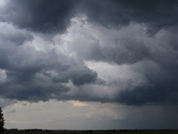
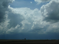
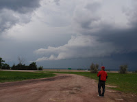
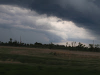
Today was actually pretty exciting since we were able to track down the best part of the storm for producing tornadoes. Everything was accounted for except for a few of the necessities in the recipe to build tornadoes. We had decent amount of CAPE, the towers were punching through the caps, we had inflow from the back of the cell, we even saw a minor shelf cloud portruding out of the storm! There was so much wind at the surface and a lot warm and moist air to help build up the storm even more. We saw some AMAZING sights but unfortunately one of those wasn't a tornado.


We even drove through pea-sized hail when we decided to cut our losses and head back towards Rapid City. We wanted to take a quick drive by the only corn palace in the world first, lol, so we went a little more into Mitchell, SD to see it.

I'm starting to realize the complexity and the beauty of tornadoes even more. It takes SO MUCH for these things to form and it truly is a work of art. We had a lot of things on our side but we had no wind shear up aloft, no helicity, no rotation really at all, and we had a lot of rain associated with this storm. There is hope for us if we actually do get a storm capable of producing tornadoes because our team is great at pinpointing the best and most capable spots thus far.
Hopefully, the next time we see such an amazing sight it'll be right before we see what we came thousands of miles to see...a tornado! We're headed to Colorado tomorrow to see what pops up for Wednesday but it looks like our best chances for anything happening for us will be near the last few days of our trip when a nice trough will be moving through Oklahoma, Nebraska, Kansas area and we'll have some jet stream streaking through the area as well.
We can seem to get uplift in any of these storms or they're dying off by moving into areas covered in cloud decks that suck up all the sun's radiation. We need surface-level heating, strong winds aloft, high CAPE values, opposing velocities aloft, and we need helicity. So far we've only had one or a few of this things and really we need all of them for any chance of a tornado forming. Hope for the best!
Good night!
I am so jealous! But yet so excited for you and your team. I have so many friends in the areas where you going into. Keep enjoying God's nature!
ReplyDeleteIf you want to catch a tornado fast, you'll have to do it by plane. I spent twenty five years avoiding them, still came too close to some. You should see how impressive thunderstorms look like at night when you are above them or level in the distance; they are like giant light bulbs that go on and off.
ReplyDelete